Map
Map
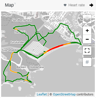
If you've used an activity tracker with GPS functionality, you will be shown the route covered during an outdoor activity. The map content is provided by various "Open Street Map" derivatives, so that running, swimming and cycling activities can be presented in a meaningful way. You can deactivate the card in the privacy settings if you don't want that reduced extracts from the position data of your activity are transmitted to the so-called tile provider.
Intensity
You can select the zone type for the route to see at which position you were at which intensity level.
Depending on the intensity, the route is then colored green, yellow or red. Blue means that no intensity could be determined at this location.
Section marking
You can view the segment numbers or segment markers on the map by clicking on the diamond symbol. The segment markers are not necessarily the kilometre markers.